Michigan - Pictured Rocks National Lakeshore and Upper Peninsula Waterfalls
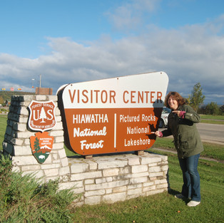
In fall, I decided to take a trip to see waterfalls in the Upper Peninsula with one of my sisters, and in the process, we also visited Pictured Rocks National Lakeshore, and walked on the North Country National Scenic Trail. We started in Escanaba, travelled up to the Pictured Rocks National Lakeshore, then headed back. It was a great one-day journey. Along the way, we stopped by several waterfalls, some within the boundaries of the Pictured Rocks National Lakeshore, but mostly just on our route. Here is what we saw:


1. Rapid River Falls - This falls is located just off Hwy 41, about 7.5 miles north of the town of Rapid River, Michigan. It is adjacent to a small park. You park about 100 feet from the river, and the walk there is very flat. Its a pretty area, with a lot of very flat rocks along the bottom of the river. The waterfall is relatively small.

2. Whitefish Falls - This falls is about 16.5 miles north of the Rapid River falls, again, right off of Hwy 41. To get to this falls, you turn onto a gravel drive off of 41, and park. There is a bit of a walk, about 75 feet, on gravel with a downhill slant. It would not be good for wheelchairs, but probably ok for someone with walking problems... as long as you park at the northern most spot.

3. Laughing Whitefish Falls - This falls is about a 25 minute drive from Whitefish Falls. You go north to Hwy 94, then east to the town of Sundell, then north on Laughing Whitefish Falls Road about 3 miles. You park in a lot, and walk about a half mile through a relatively flat forest path. The path is very well maintained. When you get to the falls, you are on top of it, looking down. There is a nice deck built there to see the falls, then about 150 steps down to the bottom. The falls has a 100 foot drop.

4. Au Train Falls - This falls is about 15 miles east of the Laughing Whitefish Falls. It is only off of 94 by about 500 feet. You park and walk down a road to see the falls. It is also next to a hydro electric power facility, and there is some information about the plant at the base of the falls.

5. Scott Falls - This falls is located RIGHT off of the road, Hwy 28, about a 15 minute drive from the Au Train Falls. At this point, you are very close to Lake Superior.. You park on the shoulder of the highway, and walk about 30 feet. You basically walk into the ditch, and then you are there.

6. Alger Falls - Alger falls is located at the intersection of Hwy 94 and Hwy 28, just east of Munising. This photo is taken from the shoulder of the road. NO walking necessary.

7. Wagner Falls - Wagner falls is only 3 miles from Alger Falls, but off of 94. You park in a small lot, and walk in about 500 feet to see the falls. It is flat, and an easy walk. While there, we met a couple that was crawling over the railing. There was a rustic path leading up the side of the falls, and if you go down that path, there is another falls back there.

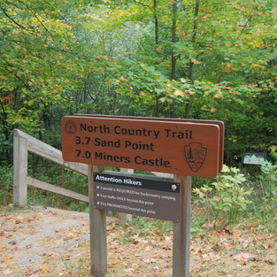
8. Munising Falls - Munising Falls is inside the Pictured Rocks National Lakeshore area, and there is a large parking lot, and an interpretive center and bathrooms at the lot. The North Country Trail goes through here too, so if you are looking to hike, this I a good place to start. There is a short hike to the falls, and at the falls, there are stairs along each side to a platform to see it from a different angle.

9. Miners' Falls - This one is located on the way to see the Miner's Castle Rock Formation, and has about a .8 mile hike to it, with a bit of elevation change.